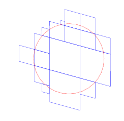
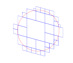
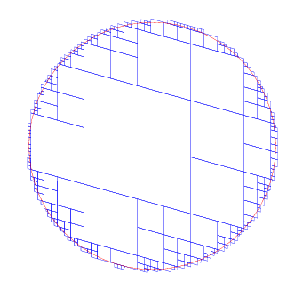
S2 Covering Examples
Here are some examples of the “cell coverage” feature of the new spherical geometry package. We pick some point on the sphere, and create a circular cap of some size around that point. We then cover the cap with some number of “cells”. The result is then projected onto a plane tangent to the center of the cap and parallel to the surface of the sphere. The cells are drawn in blue and the cap itself is drawn in red.
This point happens to be centered on the Google offices in Kirkland, with a 5 km radius cap. When you try to cover that cap with just one cell, you often end up with a large amount of extra space. Notice the large cell compared to the circle.
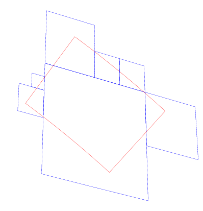
Same configuration, except we allow the use of 2 cells.
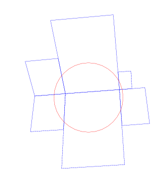
Same configuration, except we allow the use of 3 cells. One of them is quite small.
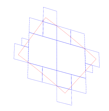
Same configuration, except we allow the use of 4 cells. I’ve changed the scale factor so we can see more detail.
Same configuration, except we allow the use of 5 cells.
Same configuration, except we allow the use of 6 cells.
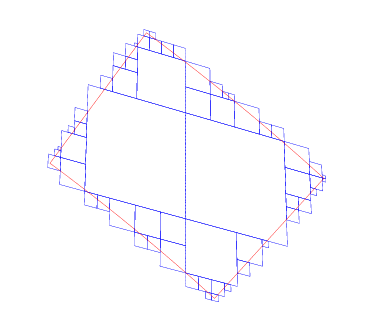
Same configuration, except we allow the use of 10 cells.
Same configuration, except we allow the use of 20 cells.
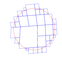
Same configuration, except we allow the use of 50 cells.
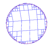
Same configuration, except we allow the use of 500 cells. The scale has been changed again to show more detail.
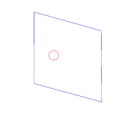
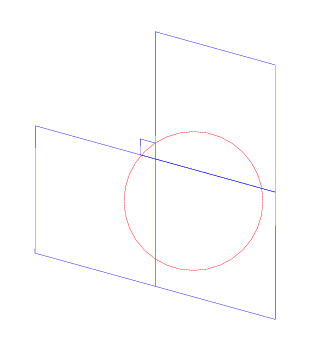
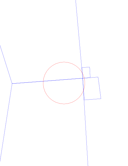
This is a point at an edge between two faces of the cubic tiling, with a cap size of about 500 km and limit of 4 cells. The ratio of “area covered by the cells” to “area covered by the cap” is about 10, which is about the worst case value when you have at least 4 cells. (The ratio can be quite large, on the order of 10\^15, if you limit the covering to fewer than 4 cells.)
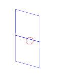
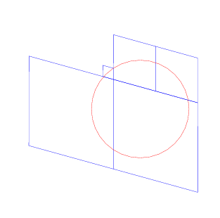
Same configuration, except we allow the use of 6 cells.
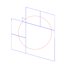
Same configuration, except we allow the use of 50 cells.
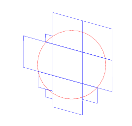
Same configuration, except we allow the use of 500 cells.
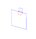
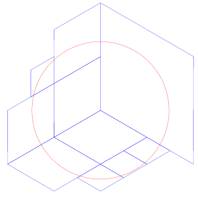
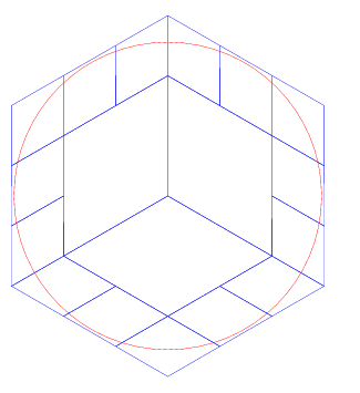
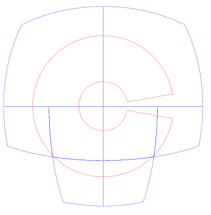
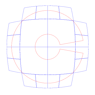
This is a point at the corner where three faces meet. The cap radius is 10 km, and we’re using 10 cells.
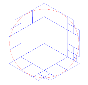
Same configuration, except we allow the use of 20 cells.
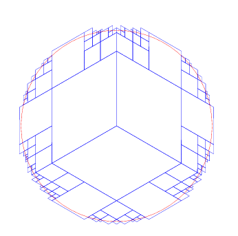
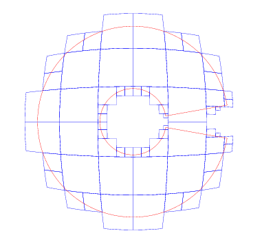
Same configuration, except we allow the use of 50 cells.
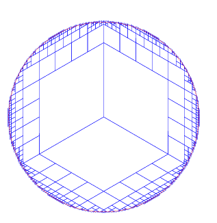
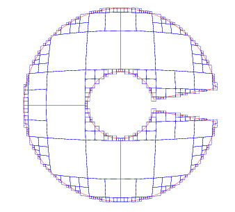
Same configuration, except we allow the use of 200 cells.
Same configuration, except we allow the use of 1000 cells. Note that in fact the code did not use all 1000 cells: this covering only uses 706 cells. There was a point where the code had 1000 candidate cells, but after pruning the code merged some adjacent sets of cells into a smaller number of larger cells. The details of the covering did not change, it is merely a more efficient representation.
This shows a latitude/longtitude rectangle (instead of a circular cap) which is roughly placed over Washington state. (The coordinate system that we’re using for the project is not oriented to put North up, which is why it looks a bit weird.) Here is a covering with 10 cells..
Same configuration, except we allow the use of 20 cells.
Same configuration, except we allow the use of 100 cells.
This shows a latitude/longtitude rectangle extends from 60 degrees north to 80 degrees north, and from -170 degrees to +170 degrees longitude. The covering is limited to 8 cells. Notice that the hole in the middle is completely covered.
Same configuration, except we allow the use of 20 cells.
Same configuration, except we allow the use of 100 cells. Now we have sufficient numbers of cells to model the hole, but not the gap near the date line.
Same configuration, except we allow the use of 500 cells.
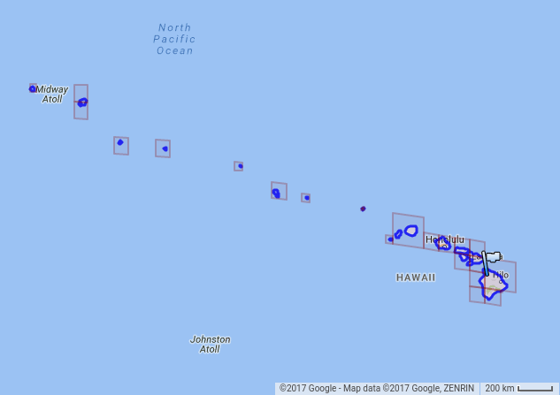
Finally, here are some examples of geographic coverings. This is a covering of Hawaii using 25 cells.
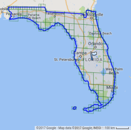
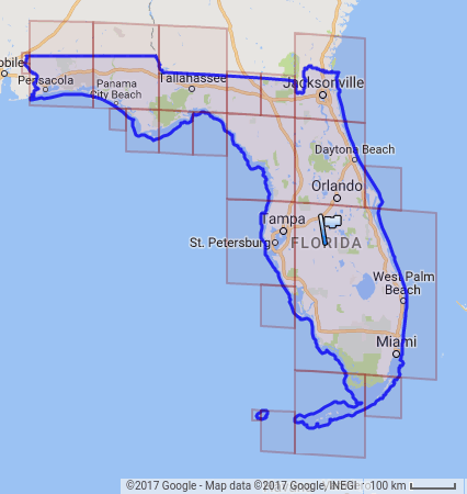
Here is a covering of Florida using 22 cells.
And Florida using 152 cells.